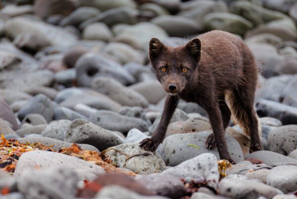
Less than 24 hours into my first trip to Scoresby Sund, the captain called me over. “We may have a polar bear.” An hour earlier, one of the other sailboats had spotted a white-yellow shape lying on a rock by the water. By the time we got close, the bear had slipped into the sea and was swimming towards an iceberg. It climbed out, walked behind a hole in the ice, looked straight through it as if it were posing for us, and then stayed up there for so long that I filled an entire memory card.
That was August 2024. I’ve been back in 2025 and 2026, and this guide is what I’d want to know before going: how you get there, when the fjords open, the route we sail, what you’ll photograph and how to fly a drone there without breaking the rules. Let’s dive in!

The polar bear I met less than 24 hours into my first trip to Scoresby Sund, looking straight through the hole in the iceberg. August 2024.
Scoresby Sund At A Glance
- Where: Greenland’s east coast. You’ll also see it written Scoresbysund, and in Greenlandic it’s Kangertittivaq.
- Getting there: charter flight from the domestic airport in Reykjavík to Constable Point (Nerlerit Inaat), a little under two hours, then by boat. There are no roads in.
- Season: from mid-July, once the ice lets boats in, until the end of September.
- How long: a week on the water. Our trips run eight days and seven nights.
- What you’ll photograph: icebergs, glacier fronts, basalt and rust-red cliffs, and wildlife: polar bears if you’re lucky, musk oxen, arctic hares and foxes ashore, seals and the occasional whale.
- Connectivity: effectively none once Constable Point is behind you.
Is Scoresby Sund Really the Largest Fjord System in the World?
It’s widely described as the largest fjord system on Earth, and the numbers explain why: one main inlet about 110 kilometres long, branching into fjords that cover roughly 38000 square kilometres, the longest reaching around 350 kilometres inland. Some of the peaks rise 1.5 kilometres or more straight out of the water, and even after six days in what is, relatively speaking, one small corner of it, we kept seeing completely new geology.
Ittoqqortoormiit, the only village within a 650 kilometre radius, sits at the mouth of the fjord. More on it below.

The remains of what must have been a magma intrusion at Red Island in the back of the fjord system. These two geological features are quite uncommonly seen together.

A flat-topped peak on the Bear Islands, lit by the last light of the evening.
How Do You Get to Scoresby Sund?
By air, then by boat. We start at the domestic airport in downtown Reykjavík and take a charter flight to Constable Point, also known as Nerlerit Inaat. The flight takes a little under two hours.
Landing at Constable Point, it’s immediately clear you’re in the middle of nowhere: a muddy airstrip, a few buildings and, when we landed in 2024, three sailboats waiting for us. On the short walk down to the improvised pier we’d already seen an arctic fox. From there it’s people and luggage into the boats and away. There are no roads into the fjord system and no scheduled way in for visitors, so however you go, you’ll be on a boat.

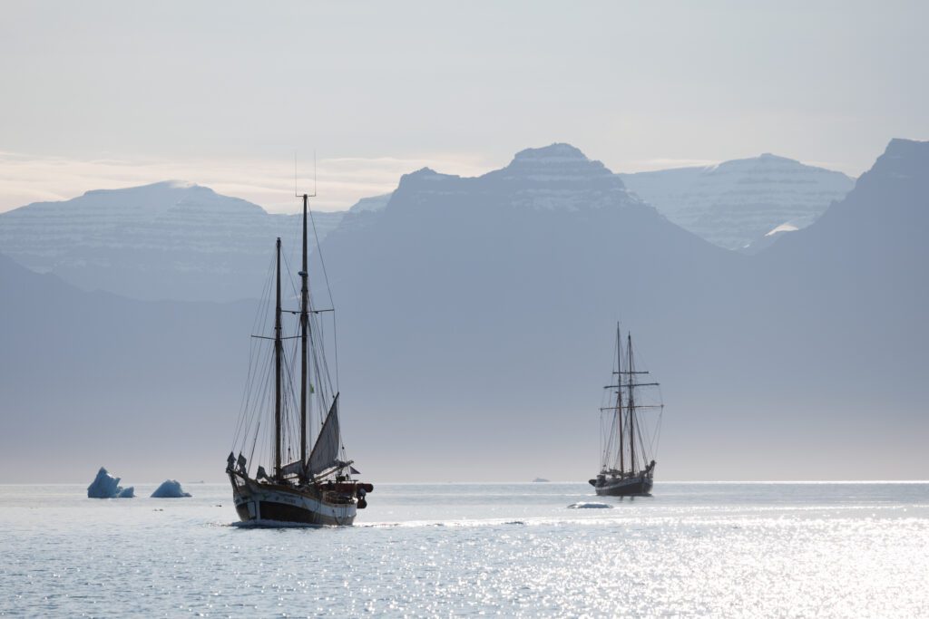
Tilvera, the sailboat that was our home for the week in 2024.
When Is the Best Time to Photograph Scoresby Sund?
The window is short. The area only becomes accessible from mid-July, and you can sail it until the end of September, before it starts freezing over again. Earlier in the summer the sea ice often hasn’t cleared enough to get deep into the fjords.
I like late August. The sun sets again after the midnight-sun months, so you get real sunsets and long twilight, and by then the ice has usually opened up.
In 2024 we had exactly one moody morning. The rest of the week was blue skies and the flattest water I’ve ever seen, and I’m not going to lie: I grumbled about those blue skies. The sunsets made up for it.
2025 was much the same, apart from one stormy day with really atmospheric clouds, which was great. 2026 was a different story: two days below zero, the ocean even began to freeze overnight once, snow covered the highest peaks, and one morning we woke up to snow. Pack for both.
And yes, you can see the aurora out there. We had a great display of the northern lights once in 2026, on our final night near the airstrip.

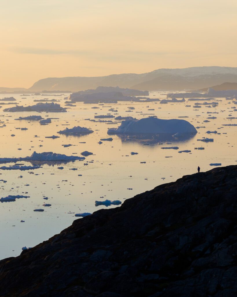
Sunset over Iceberg City at Red Island.

The one moody morning we had in 2024.

And one of the sunsets that made up for all those blue skies.
What Is the Route Through the Fjords?
The route changes every trip, depending on where the ice lets you go. This is the loop we sailed in August 2024 aboard Tilvera. Neither Andy Mumford, who co-led that trip with me, nor I had been before, so our brief to the crew was simple: our goal is photography, you know the area, we trust you. They picked well.
| Stop | What’s there | What I photographed |
|---|---|---|
| Sol glacier | A glacier outlet on the southern side, reached by sailing through the first night | Icebergs and the glacier front, and our first drone flights from a moving boat |
| The southern shore | Thick layers of columnar basalt | The basalt, in the only moody light of the week |
| Fønfjord and Milne Land | Narrow, iceberg-filled passages as you circle the island | Icebergs up close from the deck |
| Red Island (Rødeø) | “Iceberg City”, where icebergs run aground and stay until they melt | Cruising between the bergs at sunset, then landing to fly the drones |
| Rødefjord | Glassy water and more giant icebergs under rust-red cliffs | Reflections, and one enormous iceberg near our anchorage |
| Øfjord and the Bear Islands | Long, pointed ridges like a dragon’s spine sticking out of the water | Telephoto work on the big peaks, and our last sunset |
| The run home | Through the night to Ittoqqortoormiit, then back to Constable Point | A walk through the village |
In 2026 we roughly kept the same loop around Milne Land, but spent far more time in Vikingefjorden, because of the bears and the glacier.

An incredible sunrise on the Bear Islands during my last photo expedition to the area.

Columnar basalt on the southern shore of Scoresby Sund.

Icebergs reflected in glassy water under a pink sky in Iceberg City.
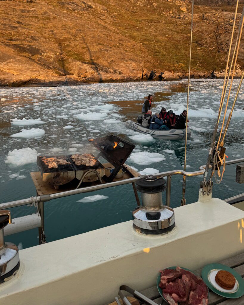
Travelling on a sailboat means slow travelling. If there’s an interesting iceberg or an animal, you stop, or you circle it. We helped the crew hoist the sails, took turns at the wheel and kept an ice watch through the night to keep clear of the bigger bergs. One evening an iceberg calved nearby and we ended up completely enclosed in slush ice, with the barbecue still going on deck.

The barbecue kept going on deck while the slush ice closed in around us.

One morning we woke up expecting a nice sunrise but we were met with fresh snow falling from the sky instead. That still gave us the opportunity to capture incredible images like this old basalt formation.

In 2026, we had a chance to photograph some of the beautiful autumn colours that began to appear towards the end of the season.
Will You See Polar Bears in Scoresby Sund?
Possibly, but there’s never a 100% guarantee. These are wild animals after all! However, I’ve seen them on all three trips, and 2026 was the best yet. Before the first trip I’d read in the Icelandic papers that more bears were being sighted that year because the sea ice had come much further south than usual, so I knew it could happen. I just didn’t expect it within a day. I’d seen a polar bear in the wild once before, in Svalbard in 2019.
The 2024 bear is the one at the top of this guide. Only when we went through the images afterwards did we realise it had been hunting a seal none of us had even noticed. In 2025 it was a bear swimming through slush ice, stopping every now and then to float and sniff the air for seals. And in 2026 we saw five polar bears in Vikingefjorden. On our first night there, a mother and cub came down to the shoreline to have a look at us.
We never chase them, from the boat or otherwise. We keep our distance and let the bear decide what happens next.

My favourite image of the 2024 bear, sniffing the air on top of the iceberg. Canon EOS R5 and RF 100-500mm.

The 2024 bear hunting a seal along the shoreline, far below the cliffs.

The 2025 bear swimming through the slush ice, stopping every now and then to sniff the air for seals.
What Else Lives There?
More than you’d expect in a place this bare. There are musk oxen and arctic hares on the slopes, arctic foxes (the first one met us at the airstrip), and seals and the occasional whale in the water. None of it is guaranteed, and a week in Scoresby Sund is about the ice and the light first, but 2026 still gave us some great musk ox encounters.

During a hike, we encountered a herd of musk ox deep in Rypefjorden and got the most amazing images with the autumn colours.
What Gear Works in Scoresby Sund?
Bring more reach and more width than you think you’ll need.
- Telephoto: my Canon EOS R5 with the RF 100-500mm did the heavy lifting in 2024, both for the polar bear and for the flat-topped peaks around the Bear Islands. I’d want something in the 100-400mm range or longer again.
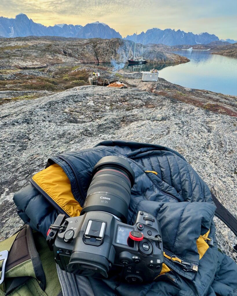
- Ultra-wide: the RF 14-35mm f/4 was absolutely key for the sunsets over Iceberg City, when the whole sky lit up.
- Drone: a DJI Mavic 3 Pro in 2024 and a Mavic 4 Pro in 2025. For the big icebergs the drone beat the zodiacs, because flying over them doesn’t break up the reflections on the water the way a boat does.
- Spare memory cards. See the polar bear.

My Canon on the Bear Islands, with Tilvera moored behind.
The ice spiral that won the Snow & Ice category at ILPOTY 2024 formed so close to the shore that I had to improvise the composition to keep the land out of the frame. It’s a three-shot bracketed vertical panorama from the Mavic 3 Pro.

The ice spiral that won the Snow & Ice category at ILPOTY 2024. A three-shot bracketed vertical panorama from the Mavic 3 Pro.
Can You Fly a Drone in Scoresby Sund?
Yes, within the rules.
Greenland doesn’t issue its own drone licence, and an EU certificate doesn’t carry over. You fly under the Danish regulation BL 9-4: a maximum of 100 metres above ground level, 150 metres clear of built-up areas, and no recreational flying inside towns at all. If a trip takes you into Northeast Greenland National Park, flying there needs a permit in your own name, and most requests don’t succeed.
In practice we launch and land straight off the deck, often while the boat is moving, because deep in a fjord there’s rarely anywhere else to set a drone down. The first flights at Sol glacier doubled as a lesson for everyone who’d never flown from a moving boat before. One evening the sunset was so good that I flew the drone back to a large iceberg 2.5 kilometres away, just to get that shot.
I’ve written separately about the drone rules in Greenland and flying a drone from a boat if you want the details.

A 2025 sunset in Scoresby Sund, shot with the Mavic 4 Pro.

Flying from the deck: Tilvera alongside an iceberg.

A top down capture of the side of a beautiful blue iceberg near Bear Islands during my last expedition in 2026.
Ittoqqortoormiit: The Village at the Mouth of the Fjord
Ittoqqortoormiit is the only village within a 650 kilometre radius. It sits on the north shore where Scoresby Sund meets the Greenland Sea, and every one of my three trips has gone ashore there on the way out. The Danish name is Scoresbysund, which is why you’ll see both on maps.
What Does Ittoqqortoormiit Mean?
In East Greenlandic it means roughly “the people who live in the big houses”.
How Many People Live There?
About 326, according to Statistics Greenland’s 2026 figures. You’ll see anything from 324 to 500 quoted online, because many pages still use numbers from ten or twenty years ago. In 2006 it was still over 500.
Why Is There a Village Here at All?
It was founded in 1925, when Denmark resettled Inuit families from Tasiilaq, around 800 kilometres to the south, under the explorer Ejnar Mikkelsen. The motive was partly political: Denmark and Norway were arguing over East Greenland at the time, and a settlement strengthened the Danish claim. Hunting is still part of life there, alongside the jobs that keep a village running: the school, the shop, the hospital and the helipad.
How Do You Get to Ittoqqortoormiit?
There’s no road in or out. Most visitors fly from Iceland to Nerlerit Inaat (Constable Point), about 40 kilometres away across the fjord, and cover the last stretch by Air Greenland helicopter. In summer you can also arrive by ship, which is how I’ve done it every time. In 2025 it was decided to build an airport in the village itself, paid for by Denmark, which would do away with the helicopter leg. I haven’t seen an opening date yet.
What’s It Like to Go Ashore?
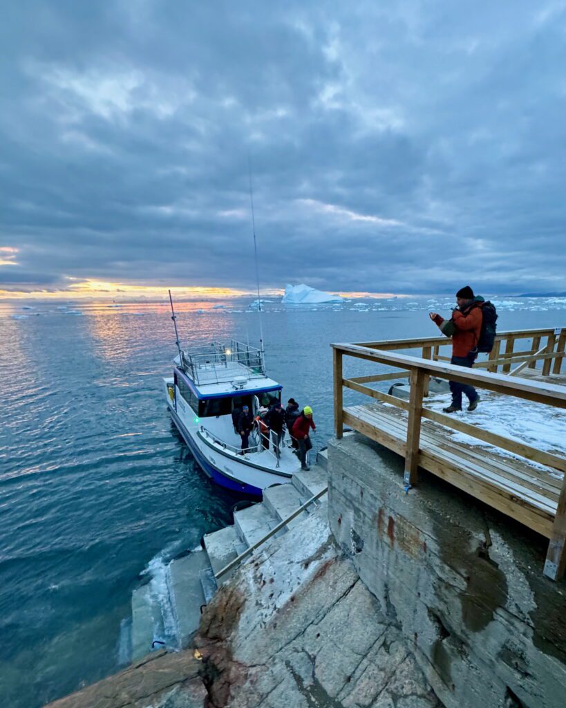
We go ashore by zodiac, landing at either the main pier or a smaller harbour, depending on the waves and the swell. From there we walk around and have a look at the village. It’s only a very small taste of what life is like in such a remote and harsh place, but it’s a taste you don’t get anywhere else on the trip. Now and then we meet some of the locals, and some of them are quite chatty.
I’ll be honest: villages aren’t really my cup of tea to photograph, so my camera stays pointed at the ice and the landscape around the fjord mouth. That’s also why you won’t find pictures of the houses in this guide.
Can You Fly a Drone in the Village?
Not recreationally. Greenland’s rules keep drones at least 150 metres from built-up areas, so the village itself is off limits. Out on the water at the fjord mouth, the usual rules above apply.
Frequently Asked Questions
Where Is Scoresby Sund?
On Greenland’s east coast, where it opens into the Greenland Sea. You’ll also see it written Scoresbysund, and its Greenlandic name is Kangertittivaq. Ittoqqortoormiit, the only village, sits at its mouth.
How Do You Get to Scoresby Sund?
Take a charter flight from the domestic airport in Reykjavík to Constable Point (Nerlerit Inaat), which takes a little under two hours, and continue by boat. There are no roads in.
When Is the Best Time to Visit Scoresby Sund?
Between mid-July and the end of September, when the ice lets boats in. I like late August, when the sun sets again and the ice has usually opened up.
Can You See Polar Bears in Scoresby Sund?
Possibly, but there’s no guarantee. I’ve seen them on all three of my trips, including five polar bears in Vikingefjorden in 2026.
Can You See the Northern Lights in Scoresby Sund?
Yes, once the nights get dark again. I saw them on my 2026 trip, on our final night near the airstrip at Constable Point.
What Are the Drone Rules in Scoresby Sund?
Greenland doesn’t issue its own drone licence and an EU certificate doesn’t carry over. You fly under the Danish regulation BL 9-4: a maximum of 100 metres above ground level, 150 metres clear of built-up areas and no recreational flying inside towns.
What Does Ittoqqortoormiit Mean?
In East Greenlandic it means roughly “the people who live in the big houses”.
How Many People Live in Ittoqqortoormiit?
About 326, according to Statistics Greenland’s 2026 figures.
How Do You Get to Ittoqqortoormiit?
Fly from Iceland to Nerlerit Inaat (Constable Point), about 40 kilometres away, and take the Air Greenland helicopter for the last stretch. In summer you can also arrive by ship.
My Verdict
Scoresby Sund sat high on my bucket list for years, and it easily made my top three trips of 2024. Three trips in, it’s the scale that stays with me, and the polar bear on that iceberg. I’m going back in 2027.

A lovely panorama taken on our arrival at the anchorage at Bear Islands. The sharp spire is called Grundtvigskirken and towers above Øfjord.
Join Me in Scoresby Sund
The East Greenland Photo Expedition 2027 runs from 25 August to 1 September 2027, with eleven places aboard Ocean Sherpa and the charter flight from Reykjavík included. All my Greenland trips are on my Greenland photo workshops page.
Want the full story of that first trip? Read my August 2024 Scoresbysund trip report.

Ocean Sherpa, the boat we sail on in 2027, at anchor among the icebergs in Vikingefjorden in 2026.
DISCOUNT
The Drone Photography Masterclass – Video Course
Nigel Danson & Jeroen Van Nieuwenhove‘s complete drone photography video masterclass will explore everything you need to know to start creating the best aerial photographs using any type of drone in 50+ detailed videos. Whether you are a complete beginner or an advanced drone pilot, this video course contains a vast amount of information to level up your drone photography skills.
Discover Jeroen’s Photo Workshops in Iceland, Greenland & Beyond
Ready to take your photography to the next level? Join me, Jeroen Van Nieuwenhove, on unforgettable photo workshops in Iceland, Greenland, Antarctica and other exciting destinations. Whether your passion is wildlife photography, bird photography, landscape adventures, or mastering drone photography, each workshop is designed to give you hands-on guidance in some of the world’s most spectacular locations.
From puffins in the midnight sun to Arctic foxes in the wild, from glaciers and volcanoes to dramatic coastlines seen by drone – these journeys are more than workshops; they’re once-in-a-lifetime experiences. Group sizes are kept small, ensuring personal mentoring and plenty of shooting opportunities.
Looking for something specific? Check out Jeroen’s…
- Wildlife & Bird Photography Workshops (Puffins, Arctic Foxes)
- Drone Photography Workshops
- Photo Workshops in Iceland
- Photo Workshops in Greenland
- Photo Workshops in Antarctica
Spots are limited – secure your place today!
Are You Looking For A Specific Photo Workshop?
All Upcoming Photography Workshops With Jeroen
Explore all upcoming photography workshops with Jeroen and take your skills to the next level in some of the world’s most extraordinary locations. From the volcanic landscapes of Iceland to the ice-filled fjords of Greenland and the wildlife-rich polar regions such as Antarctica, each workshop is designed to help you grow creatively while experiencing unforgettable moments in the field. Browse all upcoming departures below and find your next adventure!
LAST SPOTS
LAST SPOT
LAST SPOTS
OPEN FOR BOOKINGS
OPEN FOR BOOKINGS
LAST SPOTS
WAITLIST
WAITLIST
WAITLIST
WAITLIST
WAITLIST
WAITLIST
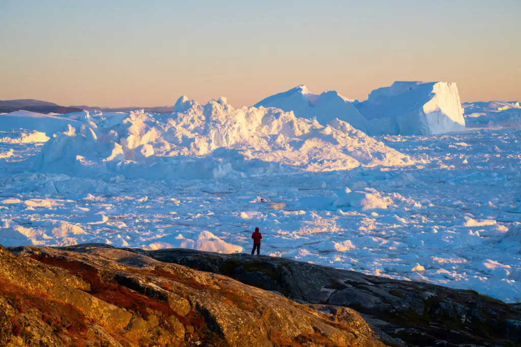
WAITLIST
What Previous Participants Shared About Their Experience
Choosing the right photography workshop is about more than just visiting iconic locations. It’s about experience, safety, timing, and personal guidance. Below you’ll find honest reviews from photographers who have joined Jeroen on landscape & drone photo workshops in Greenland. These testimonials reflect real experiences in small groups, hands-on instruction in challenging conditions, and the level of care Jeroen aims to bring to every workshop.
These reviews are verifiable on Jeroen’s public Google Business profile.
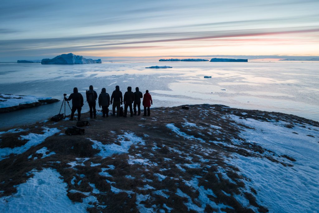
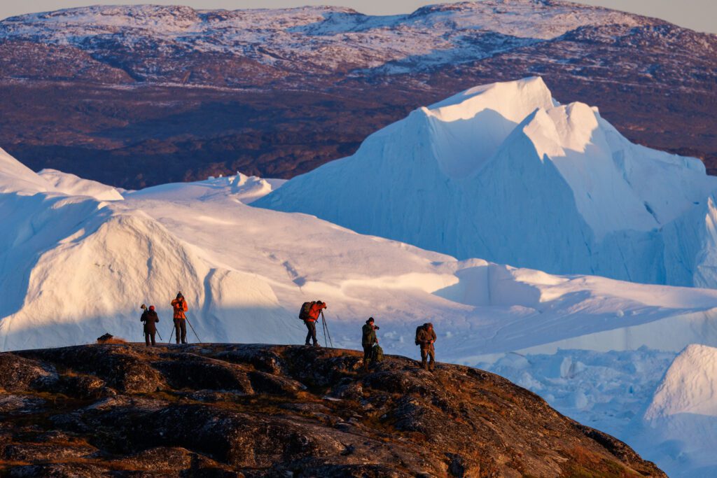


Support Jeroen’s Work
As an independent photographer, Jeroen partially relies on your support to keep producing worthwhile content such as blogs, photographs, books and much more. If you want to support his work, it is possible to do so by buying his e-books & books.
You can also sign up to the newsletter to stay up to date on new blog posts, projects, workshops and other interesting information.
Thank you for considering!